HARD WATER SURVEY OF THE TREASURE VALLEY · COMPILED 2026 · PRINTS BEAUTIFULLY AT 11×8.5
FIELD SHEET No. 1 · ADA & CANYON CO. · FREE ISSUE
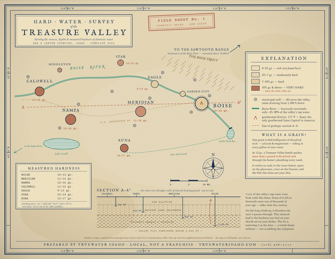
A one-of-a-kind survey map of the Treasure Valley: where your water actually comes from, how hard it runs in your city, and the mile of mineral-bearing ground it climbs through to reach your tap.
HARD WATER SURVEY OF THE TREASURE VALLEY · COMPILED 2026 · PRINTS BEAUTIFULLY AT 11×8.5
Real figures, compiled from municipal water reports and U.S.G.S. classifications.
Measured hardness, city by city. Boise, Meridian, Nampa, Caldwell, Eagle, Star and Kuna all sit in the official "very hard" range.
How deep the valley's wells go. About 70% of your tap water rises through volcanic rock, dissolving minerals the whole way up.
Where the Boise River begins, as Sawtooth snowmelt. Some groundwater under the valley is older than the country.
The underground water that heats downtown Boise and the only geothermal-heated State Capitol in America. Same geology, same minerals, your hard water.
We will email you the print-quality file, plus a few short letters about the valley's water. Unsubscribe any time.
IT IS ON ITS WAY.
Check your inbox for the print-quality file from idaho@truewateridaho.com.
Or grab it right now:
We install whole-home softeners across the Treasure Valley. Lifetime tank warranty, 10-year valve warranty, honest local pricing, and the owner answers the phone.
BOOK YOUR FREE IN-HOME QUOTE